Bloor - Bedford Parkette
Urban Plaza, below average overall (score 28, rank ~22th percentile). Strongest: enclosure; weakest: edge activation.
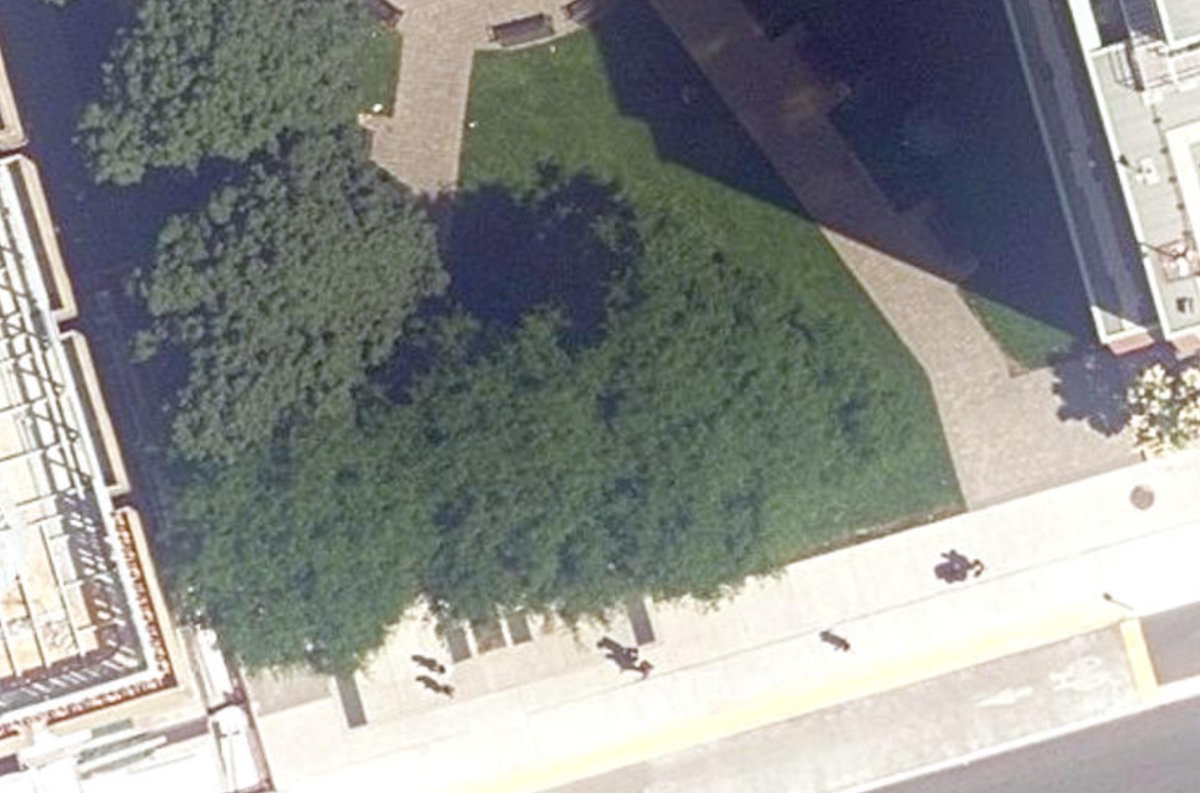
Aerial, City of Toronto orthophoto, ~8 cm/px source · cached 5/9/2026
Bloor - Bedford Parkette scores 28.1 / 100. Strongest dimensions: enclosure / eyes on park and natural comfort. Weakest: amenity diversity (0). Border-vacuum risk is elevated (72). This score is a transparent reading of Jane Jacobs-style vitality factors, not a definitive judgment.
Area · 0.04 ha
Weighted across six dimensions · confidence 54%
Scores are not bell-curved. Percentiles and expected scores provide context without changing the underlying model.
Loading map…
The parks map is loading.Explain this score
Where did the 28 come from? Each weighted contribution against a neutral 50 baseline. Green = pushed up; red = pulled down.
Sum of contributions = the headline score. A negative bar means that dimension dragged the park below the city-wide neutral baseline.
Why this park works
Bloor - Bedford Parkette works because its enclosure score (79) is above average and its natural comfort (50) is also above-average (15 mid-rise buildings frame the edge with passive surveillance).
What limits this park
Bloor - Bedford Parkette's edges are fronted by border-vacuum land uses (highways, rail, parking, blank institutional), risk score 72.
Most distinctive characteristic
Most distinctive feature: exceptionally high enclosure (79, top quartile).
Jacobs reading
Bloor - Bedford Parkette sits between an urban social park and an ecological retreat: moderately useful for both, exceptionally suited to neither.
Tradeoffs
- The park is enclosed by buildings (79) but the surrounding streets are quiet (edge activation 0): frame without animation.
Performance in context
- Reads as a modest underperformer relative to comparable parks (gap -8; cohort: pocket Urban Plaza).
Typology classification
Classified as Urban Plaza: 432 m², paved (0% canopy), 33.0 buildings/100 m
Edge Activation
Within 100 m of the park edge: 12 active uses (cafe, transit_stop, community) and 10 dead/hostile uses (parking_lot, highway, rail). Active edges keep "eyes on the park" through the day; parking lots, blank institutional walls, rail and highway frontages drain street life.
Source: OSM POIs (amenity/shop) + Toronto Building Footprints + land use
Connectivity
Connectivity blends paths, intersections, transit, entrances, and edge density. This park has 0 mapped paths/walkways and 12 sidewalk segments within 50 m; 2 street intersections within 100 m; 27 transit stops within a 400 m walk; 0 estimated access points across ~89 m of perimeter. edge density is healthy, no superblock penalty. Source coverage: centreline, pedestrian_network, transit_osm.
Source: Toronto Centreline V2 + Pedestrian Network + OSM transit stops
Amenity Diversity
No amenities recorded. Score is 0 until inventory is loaded.
Source: Toronto Parks & Recreation Facilities + OSM amenity tags
Natural Comfort
Natural Comfort requires inputs not yet loaded for this park (Treed Area / Ravine / Waterbodies / Street Trees). Score is held at a neutral 50 with low confidence. Read with caution.
Source: Treed Area / Ravine / Waterbodies / Street Trees
Enclosure / Eyes on Park
33 buildings within 25 m of the park edge (15 mid-rise, 10 low-rise, 8 tower); avg edge height 33.1 m (~11 floors); 33.0 buildings per 100 m of 89 m perimeter (strong frontage density); edges lean tall but still framed; 8 towers ≥ 40 m within 25 m of the edge. "Eyes on the park" come strongest from the 15 mid-rise edge buildings.
Source: Toronto 3D Massing (building footprints + heights)
Border Vacuum Risk
Border-vacuum factors within 50 m of the park: parking_lot, Bloor Street West, Bloor Street West. Jacobs warned that highways, rail, parking lots and blank institutional edges act as "vacuums" that suppress foot traffic and isolate the park from its neighbourhood.
Source: Toronto Street Centreline (highways) + rail layer + OSM landuse + building footprints
Equity Context
Equity Context requires inputs not yet loaded for this park (Toronto Neighbourhood Profiles). Score is held at a neutral 50 with low confidence. Read with caution.
Source: Toronto Neighbourhood Profiles
Amenities (0)
No amenities recorded for this park.
Nearby active-edge features (57)
- highway: Bloor Street West12 m
- highway: Bloor Street West18 m
- cafe: Tim Hortons19 m
- transit stop: OISE Entrance20 m
- parking lot31 m
- transit stop: Bedford Road33 m
- community: OISE Library36 m
- transit stop: Bedford Road46 m
- transit stop: St George Station56 m
- highway: Bloor Street West56 m
- transit stop: St. George57 m
- transit stop: St. George57 m
- highway: Bloor Street West59 m
- transit stop: Bedford Road Entrance61 m
- cafe: Starbucks64 m
- transit stop: St. George66 m
- transit stop: St. George66 m
- parking lot68 m
- rail76 m
- rail77 m
- rail77 m
- rail77 m
- highway: Bloor Street West100 m
- rail: Bloor-Danforth Line103 m
- transit stop: Prince Arthur Avenue105 m
- cafe: L'Espresso Bar Mercurio106 m
- parking lot106 m
- highway: Bloor Street West109 m
- restaurant: Proof118 m
- restaurant: Duke of York118 m
- transit stop120 m
- restaurant121 m
- restaurant: Opus Restaurant128 m
- retail: Gateway Newstands128 m
- transit stop: St George Street129 m
- highway: Bloor Street West129 m
- highway: Bloor Street West132 m
- retail: tmpt(d)135 m
- school: The Shire School138 m
- transit stop: St George Street140 m
- parking lot: Toronto Parking Authority152 m
- highway: Bloor Street West156 m
- restaurant: Trattoria Fieramosca156 m
- transit stop: St George Street158 m
- restaurant: Bedford Academy160 m
- cafe: b espresso bar164 m
- parking lot169 m
- parking lot171 m
- retail: Specs On Bloor176 m
- parking lot182 m
- restaurant: Bar Mercurio183 m
- cafe: Second Cup186 m
- highway: Bloor Street West187 m
- parking lot189 m
- retail: International News Plus192 m
- highway: Bloor Street West194 m
- parking lot195 m
Park profile
Five-axis radar across the structural dimensions.
Citywide percentile ranks
Across all Toronto parks in the dataset.
- Overall vitality22th
- Edge activation47th
- Connectivity54th
- Amenity diversity52th
- Natural comfort60th
- Enclosure82th
Most similar parks
Closest in metric space across the five structural dimensions.
- Birchview Boulevard ParketteUrban Plaza36
- Public Access PropertyCorridor / Linear Park34
- Glenview ParketteUrban Plaza34
- Etobicoke Civic CentreCivic Square26
- JOSEPH BRANT SENIOR ELEMENTARY SCHOOL - Building GroundsNeighbourhood Park33
Most opposite parks
Furthest in metric space. Useful for recognising what kind of park this isn’t.
- Kew GardensNeighbourhood Park71
- Leslie Grove ParkParkette68
- Bellevue Square ParkCivic Square66
- Market Lane ParkUrban Plaza63
- ALEX WILSON COMMUNITY GARDEN - Open Green SpaceUrban Plaza59
Human activity signals: not available
No activity signals have landed for this park yet. The model has scored its physical form but it can’t yet say how often it’s programmed, photographed, or walked through. See /data-ethics for what we will and will not collect.
Does this score feel accurate?
Your read of Bloor - Bedford Parkettematters. We’re testing whether the model lines up with how people actually use the park. Submissions are stored locally; no account needed.
Tell us how this park feels
We measure structure (canopy, edges, connectivity). You measure feeling. Both matter, and disagreement is itself useful civic data.
What would improve this park?
Generated from the weakest measured dimensions: a starting point, not a prescription.
- Activate the edges: encourage cafés, retail or community uses on the streets that face the park; replace blank or parking-lot edges where possible.
- Add or open more entrances and improve sidewalk continuity around the park. More permeability means more spontaneous use.
- Diversify what people can do in the park (playground, washroom, water, shade, performance, sport, garden): even small additions raise this score.
- Mitigate border vacuums (highways, rail, parking) with active programming on the still-permeable edges and treat the hostile edge as a design challenge.
Data sources
- City of Toronto Open Data: Parks (Green Space)Polygon boundaries, official names, types.
- Parks & Recreation FacilitiesInventory of in-park amenities (washrooms, fields, rinks…).
- Toronto Pedestrian NetworkSidewalk segments around and through parks; estimated park entrances.
- Toronto Centreline V2Street segments + intersection nodes near park edges; trails and walkways.
- Toronto 3D MassingBuilding footprints + heights for edge-building counts, frontage density, and tower-in-the-park risk.
- Toronto Treed AreaTree canopy share inside park polygons via stratified-grid sampling.
- Toronto Waterbodies & RiversWater surface inside parks + nearest-water distance for cooling.
- Ravine & Natural Feature ProtectionRavine overlap as a cooling / natural-comfort signal.
- Toronto Street Tree InventoryTree count + density inside park polygons.
- Neighbourhood Profiles(Pending) Equity context proxy.
- OpenStreetMap (Overpass API)Cafés, restaurants, retail, transit stops, parking, highways, rail.